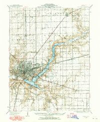
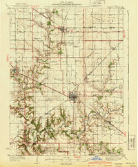
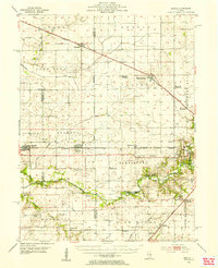
1929 Map of Decatur
USGS Topo · Published 1965About this map
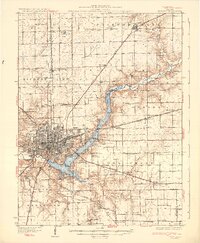
Lake Decatur dominates the central landscape of this survey, illustrating the significant hydrological engineering of the Sangamon River that reshaped the region's geography. The city of Decatur serves as a dense industrial and transit hub, where the Illinois Central, Wabash, and Baltimore and Ohio railroads converge to form a complex shipping network. The surrounding rural townships like Hickory Point and Long Creek are remarkably dense with small school districts, including the curiously named Blue Door Sch and Walnut Grove College Sch. This map documents a transition from an agrarian prairie to an organized municipal center, evidenced by the development of the Decatur Airport and recreational sites like Faries Park and the Municipal Beach along the reservoir's edge. Genealogists can find numerous country schools and cemeteries, such as Graceland Cem, punctuating the sections.
Find a feature on this map
81 named features on this map. Tap any name to fly to it.
Don’t see what you’re looking for? This feature index may not catch every label — zoom into the map to look around manually.
Map Details
Editions of this 1929 Decatur Map
This is the sole edition of this map. No revisions or reprints were ever made.
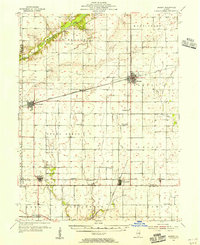
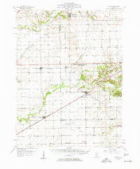
Other maps of this area
1933 · Decatur
USGS Topo · 1:62,500
1935 · Sullivan
USGS Topo · 1:48,000
1937 · Monticello
USGS Topo · 1:48,000
1940 · Sullivan
USGS Topo · 1:62,500
1943 · Monticello
USGS Topo · 1:62,500
1949 · Dalton City
USGS Topo · 1:62,500
1952 · Assumption
USGS Topo · 1:62,500
1954 · Niantic
USGS Topo · 1:62,500
1955 · Bement
USGS Topo · 1:62,500
1957 · Kenney
USGS Topo · 1:62,500