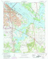
1975 Map of Decatur
USGS Topo · Published 1983About this map
The Tennessee River dominates the landscape here as Wheeler Lake, defining the boundary between Limestone and Morgan counties and supporting the busy Decatur Harbor. Along the southern bank, the city of Decatur shows significant mid-century expansion into neighborhoods like Fairview and Austinville, while industrial and infrastructure footprints are evident near the Louisville and Nashville railroad lines.
Find a feature on this map
93 named features on this map. Tap any name to fly to it.
Don’t see what you’re looking for? This feature index may not catch every label — zoom into the map to look around manually.
Map Details
Editions of this 1975 Decatur Map
3 editions found
Other maps of this area

1888 · Cullman
USGS Topo · 1:125,000

1888 · Huntsville
USGS Topo · 1:125,000

1892 · Cullman
USGS Topo · 1:125,000

1892 · Huntsville
USGS Topo · 1:125,000

1935 · Danville
USGS Topo · 1:48,000

1936 · Hartselle
USGS Topo · 1:24,000

1936 · Decatur
USGS Topo · 1:24,000

1936 · Stewart Cross Roads
USGS Topo · 1:24,000

1936 · Trinity
USGS Topo · 1:24,000

1936 · Somerville
USGS Topo · 1:24,000