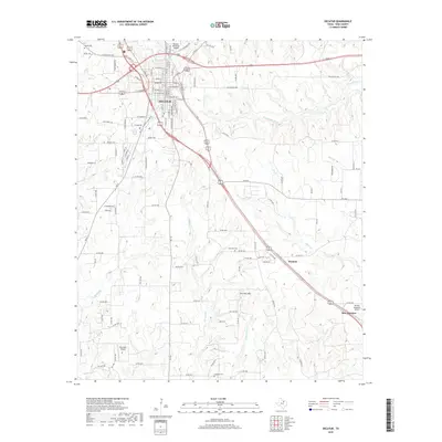
2019 Map of Decatur
USGS Topo · Published 2019About this map
Decatur serves as the central hub of this North Texas landscape, where the street grid fans out from the historic center through corridors like W Main St and S Washburn St. The map captures a transition from the urban core to the surrounding prairie, marked by a network of rural routes such as Old Denton Hwy and Old Chico Rd. Aviation is a notable theme in the local infrastructure, with Decatur Municipal Airport and the smaller Flat Bush Airport both servicing the county. Genealogy researchers will find several well-defined burial sites, including Bethel Cem to the northwest and Sand Hill Cem near the smaller community of Herman. The terrain is characterized by rolling drainages like Sweetwater Cr and Walnut Cr, which lead toward the prominent elevation of Pat Dick Hill in the southeastern quadrant near New Fairview.
Find a feature on this map
49 named features on this map. Tap any name to fly to it.
Don’t see what you’re looking for? This feature index may not catch every label — zoom into the map to look around manually.
Map Details
Editions of this 2019 Decatur Map
This is the sole edition of this map. No revisions or reprints were ever made.
Other maps of this area

1924 · Sunset 4-d
USGS Topo · 1:48,000

1930 · Boyd
USGS Topo · 1:62,500

1954 · Sherman
USGS Topo · 1:250,000

1958 · Sherman
USGS Topo · 1:250,000

1960 · Bridgeport East
USGS Topo · 1:24,000

1960 · Decatur
USGS Topo · 1:24,000

1960 · Boyd
USGS Topo · 1:24,000

1960 · Cottondale
USGS Topo · 1:24,000

1960 · Bluett
USGS Topo · 1:24,000

1960 · Rhome
USGS Topo · 1:24,000