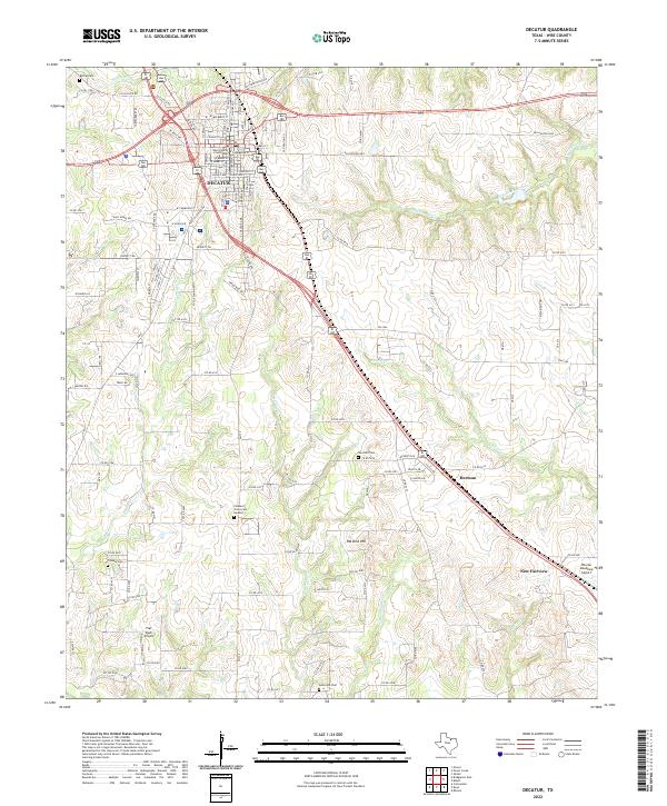
2022 Map of Decatur
USGS Topo · Published 2022About this map
The Wise County Courthouse anchors the historic downtown grid of Decatur, surrounded by a dense network of residential streets such as W Mulberry St and E Hallsell St. This Wise County landscape transitions from the urban center of Decatur toward the outlying communities of Herman and New Fairview to the southeast. The geography is defined by a series of north-south drainage patterns, including Walnut Cr and Sweetwater Creek, which carve through the terrain near landmarks like Pat Dick Hill.
Find a feature on this map
124 named features on this map. Tap any name to fly to it.
Don’t see what you’re looking for? This feature index may not catch every label — zoom into the map to look around manually.
Map Details
Editions of this 2022 Decatur Map
This is the sole edition of this map. No revisions or reprints were ever made.
Other maps of this area

1924 · Sunset 4-d
USGS Topo · 1:48,000

1930 · Boyd
USGS Topo · 1:62,500

1954 · Sherman
USGS Topo · 1:250,000

1958 · Sherman
USGS Topo · 1:250,000

1960 · Bridgeport East
USGS Topo · 1:24,000

1960 · Decatur
USGS Topo · 1:24,000

1960 · Boyd
USGS Topo · 1:24,000

1960 · Cottondale
USGS Topo · 1:24,000

1960 · Bluett
USGS Topo · 1:24,000

1960 · Rhome
USGS Topo · 1:24,000