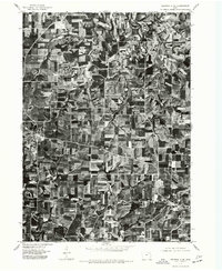
1975 Map of Decorah 3 NE
USGS Topo · Published 1977About this map
Calmar and Ossian anchor this 1975 orthophotoquad in Winneshiek County, Iowa, providing a literal view of the landscape during the mid-seventies. This imagery, captured by the Geological Survey in late September, reveals the intricate patchwork of contour-plowed fields and windbreaks characteristic of the region's agricultural heritage. The diagonal path of the railroad and the primary highways connecting these two settlements are clearly visible, cutting across the rhythmic patterns of the farmland. Unlike a traditional topographic map, this aerial survey allows researchers to see the exact footprint of farmsteads and the density of local woodlands at a specific moment in time before further modern development altered the rural layout.
Find a feature on this map
2 named features on this map. Tap any name to fly to it.
Don’t see what you’re looking for? This feature index may not catch every label — zoom into the map to look around manually.
Map Details
Editions of this 1975 Decorah 3 NE Map
This is the sole edition of this map. No revisions or reprints were ever made.
Other maps of this area

1906 · Decorah
USGS Topo · 1:125,000

1958 · La Crosse
USGS Topo · 1:250,000

1961 · La Crosse
USGS Topo · 1:250,000

1965 · La Crosse
USGS Topo · 1:250,000

1975 · Decorah 4 NW
USGS Topo · 1:24,000

1975 · Decorah 1 SW
USGS Topo · 1:24,000

1975 · Decorah 3 NW
USGS Topo · 1:24,000

1975 · Decorah 2 SW
USGS Topo · 1:24,000
1975 · Decorah 2 SE
USGS Topo · 1:24,000

1976 · La Crosse
USGS Topo · 1:250,000