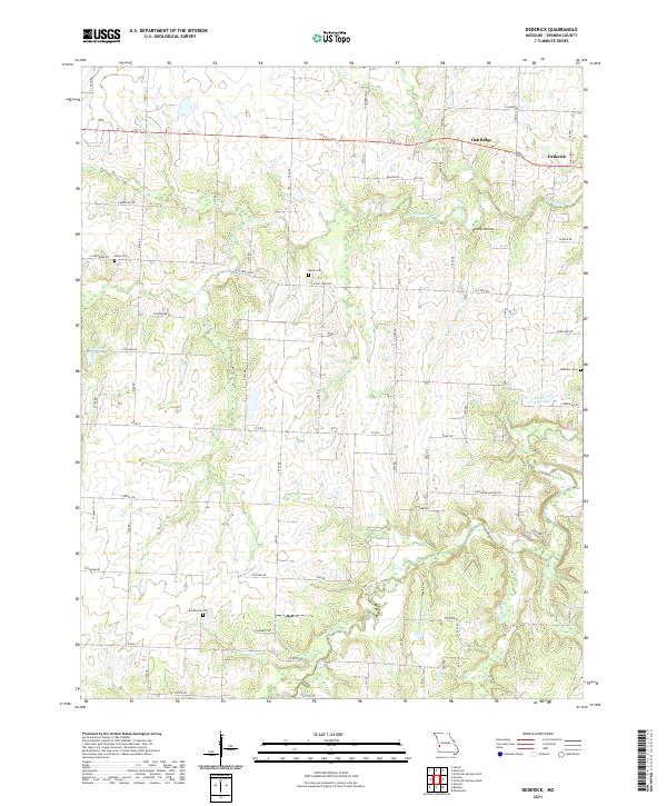
2021 Map of Dederick
USGS Topo · Published 2021About this map
Dederick and Oak Ridge stand as the primary settlements in this western Missouri landscape, situated along the northern reach of the quadrangle. The terrain is defined by the branching drainage of Clear Creek and its many tributaries, including W Fork Clear Cr and Camp Br. These watercourses carve through the landscape, creating distinct landforms such as Rocky Hollow. Small reservoirs like C H Jones Lake and Marvin Vickers Lake are scattered across the rural sections, supporting the agricultural character of the region.
Find a feature on this map
58 named features on this map. Tap any name to fly to it.
Don’t see what you’re looking for? This feature index may not catch every label — zoom into the map to look around manually.
Map Details
Editions of this 2021 Dederick Map
This is the sole edition of this map. No revisions or reprints were ever made.
Other maps of this area

1886 · Nevada
USGS Topo · 1:125,000

1894 · Nevada
USGS Topo · 1:125,000

1933 · Camp Clark
USGS Topo · 1:24,000

1938 · Horton
USGS Topo · 1:24,000

1939 · Horton
USGS Topo · 1:24,000

1939 · Dederick
USGS Topo · 1:24,000

1939 · Eldorado Springs North
USGS Topo · 1:24,000
1939 · Harwood
USGS Topo · 1:24,000

1939 · Eldorado Springs South
USGS Topo · 1:24,000
1940 · Harwood
USGS Topo · 1:24,000