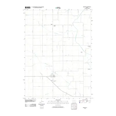
2010 Map of Dedham
USGS Topo · Published 2010About this map
The town of Dedham anchors the southern portion of this landscape, serving as a local hub for the surrounding agricultural community. The map details a sophisticated grid of rural roads, including Mahogany Ave and Olympic Ave, which connect the primary settlements of Willey in the north and the cluster at Carrollton to the east. Waterways such as Brushy Creek and Dedham Creek meander through the farmland, while the Middle Raccoon River cuts across the northeastern corner, providing recreation through the Middle Raccoon River Access. For genealogists and local historians, the sheet is particularly valuable for its clear marking of local landmarks, such as the Dedham Post Office and several parish-centered sites including Saint Josephs Cemetery and Saint Mary's Catholic Cemetery. The transition between the prairie-like level terrain and the riparian corridors of Willey Branch and Spring Branch highlights the traditional land-use patterns of Carroll County.
Find a feature on this map
37 named features on this map. Tap any name to fly to it.
Don’t see what you’re looking for? This feature index may not catch every label — zoom into the map to look around manually.
Map Details
Editions of this 2010 Dedham Map
This is the sole edition of this map. No revisions or reprints were ever made.
Other maps of this area

1954 · Omaha
USGS Topo · 1:250,000

1954 · Fort Dodge
USGS Topo · 1:250,000

1957 · Omaha
USGS Topo · 1:250,000

1957 · Fort Dodge
USGS Topo · 1:250,000

1958 · Omaha
USGS Topo · 1:250,000

1958 · Fort Dodge
USGS Topo · 1:250,000

1971 · Coon Rapids South
USGS Topo · 1:24,000

1971 · Viola Center
USGS Topo · 1:24,000

1971 · Dedham
USGS Topo · 1:24,000

1971 · Coon Rapids North
USGS Topo · 1:24,000