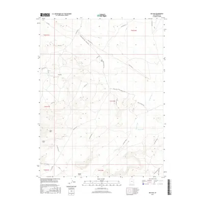
2017 Map of Dee Pass
USGS Topo · Published 2017About this map
Agate Hills dominate this portion of the high desert plateau in Grand County, where the landscape is defined by deep drainages and strategic crossings. The map traces the essential transport corridors of the region, including the Ruby Ranch Rd and the Moab to Boulder Town route, which historically connected these isolated ranching and mining outposts. The concentration of water features like Salt Wash and Thompson Wash provides a clear view of the natural infrastructure that dictated movement through this arid environment. Significant landmarks such as Dee Pass and Duma Point offer geographic orientation within the surrounding Mancos Desert W. The inclusion of the White Wash Area and Tenmile Canyon highlights the specialized topography of south-central Utah, where seasonal washes and canyon systems have long served as both barriers and pathways for those navigating the backcountry.
Find a feature on this map
23 named features on this map. Tap any name to fly to it.
Don’t see what you’re looking for? This feature index may not catch every label — zoom into the map to look around manually.
Map Details
Editions of this 2017 Dee Pass Map
This is the sole edition of this map. No revisions or reprints were ever made.
Other maps of this area

1885 · San Rafael
USGS Topo · 1:250,000

1885 · La Sal
USGS Topo · 1:250,000

1951 · The Knoll
USGS Topo · 1:62,500

1952 · Moab 3 NE
USGS Topo · 1:24,000

1952 · Tidwell 4 NE
USGS Topo · 1:24,000

1952 · Moab 3 NW
USGS Topo · 1:24,000

1954 · Tidwell 1 NE
USGS Topo · 1:24,000

1954 · Tidwell 1 SE
USGS Topo · 1:24,000

1954 · Green River
USGS Topo · 1:62,500

1956 · Salina
USGS Topo · 1:250,000