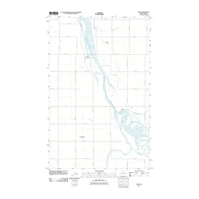
2011 Map of Deep
USGS Topo · Published 2011About this map
The Souris River dominates this McHenry County landscape, meandering through a series of complex wetlands and channels that define the region's hydrography. The water management system is anchored by Dam Number 332 and the adjacent Unit 332 Reservoir, which facilitate drainage and conservation near the small settlement of Deep. The map reveals a highly structured agricultural grid, where long straight roads like Grassland Trl and various numbered sections intersect the river's natural path.
Find a feature on this map
31 named features on this map. Tap any name to fly to it.
Don’t see what you’re looking for? This feature index may not catch every label — zoom into the map to look around manually.
Map Details
Editions of this 2011 Deep Map
This is the sole edition of this map. No revisions or reprints were ever made.
Other maps of this area

1948 · Newburg SW
USGS Topo · 1:24,000

1949 · Newburg SW
USGS Topo · 1:24,000

1949 · Landa SW
USGS Topo · 1:24,000

1949 · Kramer
USGS Topo · 1:24,000

1950 · Newburg
USGS Topo · 1:24,000

1950 · Kramer
USGS Topo · 1:24,000

1950 · Deep
USGS Topo · 1:24,000

1950 · Upham
USGS Topo · 1:24,000

1950 · Newburg SE
USGS Topo · 1:24,000

1950 · Landa SW
USGS Topo · 1:24,000