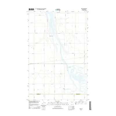
2014 Map of Deep
USGS Topo · Published 2014About this map
The Souris River meanders through this portion of McHenry County, defining a complex riparian corridor characterized by the Unit 332 Reservoir and the confluence of Stone Creek and the Deep River. The small settlement of Deep serves as a central landmark in this agricultural landscape, situated just north of the Deep River Cem. This 2014 survey illustrates a highly structured section-line road network, including Grassland Trl and various numbered streets that navigate the terrain around LaPorte Coulee. To the north, the Johnson Airport provides a point of aviation infrastructure, while the southern edge of the map follows the jurisdictional boundary between Bottineau and McHenry Counties, showing how the natural drainage systems of the Souris basin dictate the local geography.
Find a feature on this map
20 named features on this map. Tap any name to fly to it.
Don’t see what you’re looking for? This feature index may not catch every label — zoom into the map to look around manually.
Map Details
Editions of this 2014 Deep Map
This is the sole edition of this map. No revisions or reprints were ever made.
Other maps of this area

1948 · Newburg SW
USGS Topo · 1:24,000

1949 · Newburg SW
USGS Topo · 1:24,000

1949 · Landa SW
USGS Topo · 1:24,000

1949 · Kramer
USGS Topo · 1:24,000

1950 · Newburg
USGS Topo · 1:24,000

1950 · Kramer
USGS Topo · 1:24,000

1950 · Deep
USGS Topo · 1:24,000

1950 · Upham
USGS Topo · 1:24,000

1950 · Newburg SE
USGS Topo · 1:24,000

1950 · Landa SW
USGS Topo · 1:24,000