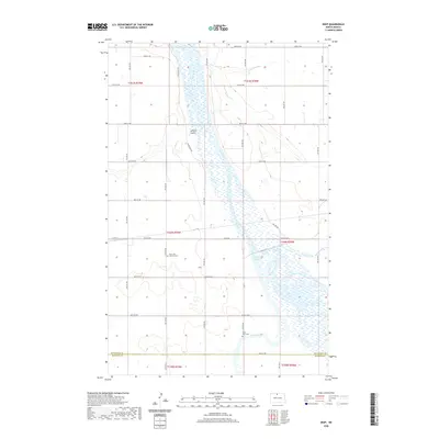
2020 Map of Deep
USGS Topo · Published 2020About this map
The Souris River meanders south through this corner of the Great Plains, defining a landscape of wide river bottoms and coulees. Near the small settlement of Deep, the river system expands into the Unit 332 Reservoir, surrounded by extensive wetlands and brush. The local geography is marked by the confluence of the Deep River and Stone Creek as they join the main channel of the Souris. This 2020 map documents the rural road grid that serves the agricultural border between Bottineau and McHenry counties. Genealogists and local historians will find significant sites such as the Saint John Lutheran Cem and the Deep River Cem, which anchor the small community history of this North Dakota prairie. The terrain features, such as LaPorte Coulee, reveal the natural drainage patterns of the region's flat topography.
Find a feature on this map
27 named features on this map. Tap any name to fly to it.
Don’t see what you’re looking for? This feature index may not catch every label — zoom into the map to look around manually.
Map Details
Editions of this 2020 Deep Map
This is the sole edition of this map. No revisions or reprints were ever made.
Other maps of this area

1948 · Newburg SW
USGS Topo · 1:24,000

1949 · Newburg SW
USGS Topo · 1:24,000

1949 · Landa SW
USGS Topo · 1:24,000

1949 · Kramer
USGS Topo · 1:24,000

1950 · Newburg
USGS Topo · 1:24,000

1950 · Kramer
USGS Topo · 1:24,000

1950 · Deep
USGS Topo · 1:24,000

1950 · Upham
USGS Topo · 1:24,000

1950 · Newburg SE
USGS Topo · 1:24,000

1950 · Landa SW
USGS Topo · 1:24,000