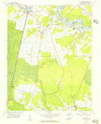
1954 Map of Deep Creek
USGS Topo · Published 1956About this map
Dismal Swamp dominates the western edge of this mid-century landscape, where the George Washington Canal and its associated Ditch systems carve straight paths through the wetlands. This survey highlights a rural Virginia economy balancing agriculture and timber, with the Lumber RR and an Old Grade Railroad serving the forested interior while the Intracoastal Waterway follows the Southern Branch Elizabeth River. Small communities and family-named corners such as Herberts Corner, Camden Mills, and Grassfield are established along the higher ground, often centered around institutions like Bethlehem Ch or Deep Creek Sch. The transition from the dense swamp to the cultivated fields of Benefit and Cornland illustrates the historic push to drain and settle this particular corner of Norfolk County, capturing the region's transport network before the era of modern suburban expansion.
Find a feature on this map
32 named features on this map. Tap any name to fly to it.
Don’t see what you’re looking for? This feature index may not catch every label — zoom into the map to look around manually.
Map Details
Editions of this 1954 Deep Creek Map
3 editions found
Other maps of this area

1907 · Norfolk
USGS Topo · 1:125,000

1918 · Cape Henry
USGS Topo · 1:62,500

1919 · Cape Henry
USGS Topo · 1:62,500

1921 · Newport News
USGS Topo · 1:62,500

1939 · Moyock
USGS Topo · 1:62,500

1940 · Lake Drummond
USGS Topo · 1:62,500

1944 · Norfolk South
USGS Topo · 1:25,000

1945 · Lake Drummond
USGS Topo · 1:62,500

1946 · Moyock
USGS Topo · 1:62,500

1948 · Norfolk South
USGS Topo · 1:24,000