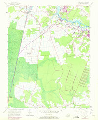
1954 Map of Deep Creek
USGS Topo · Published 1972About this map
The Dismal Swamp Canal and the Dismal Swamp Highway anchor the western edge of this landscape, marking the historic boundary of the Dismal Swamp. This survey, updated in the early 1970s from 1950s data, illustrates the transition from rural maritime and agricultural life to suburban development near the Southern Branch Elizabeth River Waterway. Settlements like Deep Creek and Grassfield are shown in detail, alongside smaller landings such as West Landing and Douglas Landing that once served as vital points of contact along the canal and river systems.
Find a feature on this map
29 named features on this map. Tap any name to fly to it.
Don’t see what you’re looking for? This feature index may not catch every label — zoom into the map to look around manually.
Map Details
Editions of this 1954 Deep Creek Map
3 editions found
Other maps of this area

1907 · Norfolk
USGS Topo · 1:125,000

1918 · Cape Henry
USGS Topo · 1:62,500

1919 · Cape Henry
USGS Topo · 1:62,500

1921 · Newport News
USGS Topo · 1:62,500

1939 · Moyock
USGS Topo · 1:62,500

1940 · Lake Drummond
USGS Topo · 1:62,500

1944 · Norfolk South
USGS Topo · 1:25,000

1945 · Lake Drummond
USGS Topo · 1:62,500

1946 · Moyock
USGS Topo · 1:62,500

1948 · Norfolk South
USGS Topo · 1:24,000