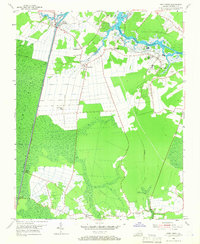
1954 Map of Deep Creek
USGS Topo · Published 1966About this map
The Dismal Swamp Canal and the George Washington Canal anchor this mid-century look at the northern reaches of the Dismal Swamp in Virginia. This landscape is defined by its complex drainage network, where the Southern Branch Elizabeth River and the Intracostal Waterway facilitate coastal movement. Smaller settlements like Deep Creek, Grassfield, and Cornland are connected by a mix of early roads and industrial spurs like the Lumber RR.
Find a feature on this map
35 named features on this map. Tap any name to fly to it.
Don’t see what you’re looking for? This feature index may not catch every label — zoom into the map to look around manually.
Map Details
Editions of this 1954 Deep Creek Map
3 editions found
Other maps of this area

1907 · Norfolk
USGS Topo · 1:125,000

1918 · Cape Henry
USGS Topo · 1:62,500

1919 · Cape Henry
USGS Topo · 1:62,500

1921 · Newport News
USGS Topo · 1:62,500

1939 · Moyock
USGS Topo · 1:62,500

1940 · Lake Drummond
USGS Topo · 1:62,500

1944 · Norfolk South
USGS Topo · 1:25,000

1945 · Lake Drummond
USGS Topo · 1:62,500

1946 · Moyock
USGS Topo · 1:62,500

1948 · Norfolk South
USGS Topo · 1:24,000