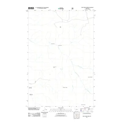
2011 Map of Deep Creek Park
USGS Topo · Published 2011About this map
Deep Creek Park occupies a central position within this Montana landscape, where the terrain is defined by a complex network of canyons and high ridges. The drainage of Deep Creek and its tributaries, including the North Fork Deep Creek and South Fork Deep Creek, carve deep into the earth between Strawberry Ridge and Deep Creek Ridge. Human presence is minimal and concentrated on access routes like Calvert Rd, which skirts the northern boundaries near Deer Butte. This area serves as a primary catchment for several water sources, most notably Robertson Spring, situated just east of the central park area. The geography transitions from the steep walls of Devil Canyon and Temple Gulch in the north to the high prominence of Desolation Peak at the southern edge, illustrating the vertical character of the Cascade County backcountry.
Find a feature on this map
16 named features on this map. Tap any name to fly to it.
Don’t see what you’re looking for? This feature index may not catch every label — zoom into the map to look around manually.
Map Details
Editions of this 2011 Deep Creek Park Map
This is the sole edition of this map. No revisions or reprints were ever made.
Other maps of this area

1886 · Great Falls
USGS Topo · 1:250,000

1886 · Fort Logan
USGS Topo · 1:250,000

1948 · White Sulphur Springs
USGS Topo · 1:250,000

1954 · Great Falls
USGS Topo · 1:250,000

1957 · Great Falls
USGS Topo · 1:250,000

1958 · White Sulphur Springs
USGS Topo · 1:250,000

1961 · White Sulphur Springs
USGS Topo · 1:250,000

1965 · White Sulphur Springs
USGS Topo · 1:250,000

1966 · Lingshire NE
USGS Topo · 1:24,000
1971 · Bald Hills
USGS Topo · 1:24,000