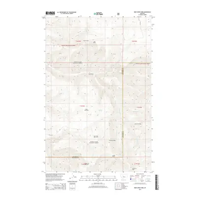
2014 Map of Deep Creek Park
USGS Topo · Published 2014About this map
Lewis & Clark National Forest encompasses this high-elevation terrain where the boundary of Cascade Co and Meagher Co follows the natural drainage divides. The landscape is defined by the headwaters of Deep Creek, which carves through Devil Canyon before opening into the meadowlands of Deep Creek Park. To the south and east, the terrain rises sharply toward prominent landmarks such as Deep Creek Ridge and the isolated height of Desolation Peak. The map illustrates a complex network of canyons and gulches, including Temple Gulch and Lobley Gulch, showing the intricate seasonal water systems that feed into the Smart Fork and North Fork Deep Creek. Human presence is sparse, marked primarily by the administrative township grids and the path of Calvert Rd in the northeast corner.
Find a feature on this map
24 named features on this map. Tap any name to fly to it.
Don’t see what you’re looking for? This feature index may not catch every label — zoom into the map to look around manually.
Map Details
Editions of this 2014 Deep Creek Park Map
This is the sole edition of this map. No revisions or reprints were ever made.
Other maps of this area

1886 · Great Falls
USGS Topo · 1:250,000

1886 · Fort Logan
USGS Topo · 1:250,000

1948 · White Sulphur Springs
USGS Topo · 1:250,000

1954 · Great Falls
USGS Topo · 1:250,000

1957 · Great Falls
USGS Topo · 1:250,000

1958 · White Sulphur Springs
USGS Topo · 1:250,000

1961 · White Sulphur Springs
USGS Topo · 1:250,000

1965 · White Sulphur Springs
USGS Topo · 1:250,000

1966 · Lingshire NE
USGS Topo · 1:24,000
1971 · Bald Hills
USGS Topo · 1:24,000