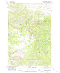
1971 Map of Deep Creek Park
USGS Topo · Published 1974About this map
Lewis and Clark National Forest encompasses the vast majority of this 1970s survey, illustrating a landscape defined by sharp drainage basins and high ridgelines. The boundary between Cascade Co and Meagher Co bisects the terrain, which is primarily accessed via an intricate network of primitive routes labeled simply as Pack Trail or Jeep Trail. These pathways follow the natural contours of the land, connecting remote points like Simmons Park and Desolation Peak.
Find a feature on this map
24 named features on this map. Tap any name to fly to it.
Don’t see what you’re looking for? This feature index may not catch every label — zoom into the map to look around manually.
Map Details
Editions of this 1971 Deep Creek Park Map
This is the sole edition of this map. No revisions or reprints were ever made.
Other maps of this area

1886 · Great Falls
USGS Topo · 1:250,000

1886 · Fort Logan
USGS Topo · 1:250,000

1948 · White Sulphur Springs
USGS Topo · 1:250,000

1954 · Great Falls
USGS Topo · 1:250,000

1957 · Great Falls
USGS Topo · 1:250,000

1958 · White Sulphur Springs
USGS Topo · 1:250,000

1961 · White Sulphur Springs
USGS Topo · 1:250,000

1965 · White Sulphur Springs
USGS Topo · 1:250,000

1966 · Lingshire NE
USGS Topo · 1:24,000
1971 · Bald Hills
USGS Topo · 1:24,000