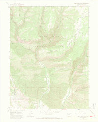
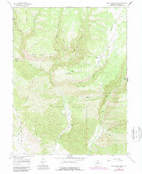
1966 Map of Deep Creek Point
USGS Topo · Published 1969About this map
White River National Forest defines the character of this high-elevation landscape in the mid-1960s, where steep drainages and prominent ridges dictate the movement of livestock and water. The map documents the localized extractive history of the region through the Gray Eagle Mine and several prospects, while the Clinetop Cow Camp indicates the area's continued use for seasonal high-country grazing. Water management is evident in the presence of the Mansfield Ditch and numerous perennial sources like Joe Hill Spring and Bear Spring.
Find a feature on this map
44 named features on this map. Tap any name to fly to it.
Don’t see what you’re looking for? This feature index may not catch every label — zoom into the map to look around manually.
Map Details
Editions of this 1966 Deep Creek Point Map
6 editions found
Other maps of this area

1906 · Grand Hogback
USGS Topo · 1:125,000

1910 · Grand Hogback
USGS Topo · 1:125,000

1927 · Glenwood Springs
USGS Topo · 1:125,000

1930 · Glenwood Springs
USGS Topo · 1:125,000

1957 · Leadville
USGS Topo · 1:250,000

1959 · Leadville
USGS Topo · 1:250,000

1960 · Leadville
USGS Topo · 1:250,000

1962 · Leadville
USGS Topo · 1:250,000

1962 · New Castle
USGS Topo · 1:24,000

1962 · Storm King Mountain
USGS Topo · 1:24,000