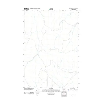
2011 Map of Deep Creek SE
USGS Topo · Published 2011About this map
Bad Pass Rd winds through the western portion of this Montana landscape, following the general path of East Pryor Creek. This drainage network in Big Horn County is defined by its numerous named tributaries, including Push Creek and Scott Creek which feed into the area from the northeast. The geography is characterized by a complex system of seasonal and perennial waterways like Shively Creek and Flat Creek, reflecting a semi-arid terrain where water sources dictate the movement of roads and historical usage. The presence of Red Spring Creek and Spring Creek further highlights the vital role of these hydrological features in an area with sparse infrastructure, where the primary named road follows the natural contours of the stream valleys.
Find a feature on this map
8 named features on this map. Tap any name to fly to it.
Don’t see what you’re looking for? This feature index may not catch every label — zoom into the map to look around manually.
Map Details
Editions of this 2011 Deep Creek SE Map
This is the sole edition of this map. No revisions or reprints were ever made.
Other maps of this area

1954 · Billings
USGS Topo · 1:250,000

1957 · Billings
USGS Topo · 1:250,000

1958 · Billings
USGS Topo · 1:250,000

1964 · Big Ice Cave
USGS Topo · 1:24,000
1964 · Horse Coulee
USGS Topo · 1:24,000
1964 · Dead Indian Hill
USGS Topo · 1:24,000

1964 · East Pryor Mountain
USGS Topo · 1:24,000

1967 · Deep Creek SE
USGS Topo · 1:24,000

1967 · Deep Creek
USGS Topo · 1:24,000

1967 · Deep Creek SW
USGS Topo · 1:24,000