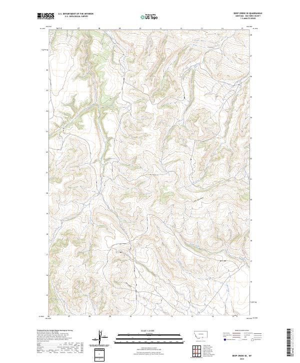
2024 Map of Deep Creek SE
USGS Topo · Published 2024About this map
East Pryor Creek and its many seasonal tributaries carve through this high-elevation terrain in Big Horn County, Montana. The landscape is defined by its drainage network, where Shively Creek and Push Creek cut through deep draws toward the larger valley. In the eastern portion of the sheet, Little Mountain rises as a prominent landmark, overlooking the headwaters of Scott Creek and Spring Creek. This 2024 survey reflects the modern management of these public and private lands, showing the intricate contouring of the coulees and ridges that separate the Flat Creek and Red Spring Creek basins. The map illustrates a section of the American West where the topography dictates the movement of water and the layout of rural access roads, centered around features like Pine Coulee in the southern reaches.
Find a feature on this map
15 named features on this map. Tap any name to fly to it.
Don’t see what you’re looking for? This feature index may not catch every label — zoom into the map to look around manually.
Map Details
Editions of this 2024 Deep Creek SE Map
This is the sole edition of this map. No revisions or reprints were ever made.
Other maps of this area

1954 · Billings
USGS Topo · 1:250,000

1957 · Billings
USGS Topo · 1:250,000

1958 · Billings
USGS Topo · 1:250,000

1964 · Big Ice Cave
USGS Topo · 1:24,000
1964 · Horse Coulee
USGS Topo · 1:24,000
1964 · Dead Indian Hill
USGS Topo · 1:24,000

1964 · East Pryor Mountain
USGS Topo · 1:24,000

1967 · Deep Creek SE
USGS Topo · 1:24,000

1967 · Deep Creek
USGS Topo · 1:24,000

1967 · Deep Creek SW
USGS Topo · 1:24,000