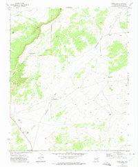
1972 Map of Deep Lake
USGS Topo · Published 1975About this map
Navajo Tribe Ranch Headquarters stands as the primary hub of human activity in this arid corner of Apache County, situated near the seasonal drainage of Hardscrabble Wash. The landscape is defined by its water management and geographic landmarks, featuring a series of ephemeral basins and catchments such as Deep Lake, Red Lake, and Hogan Lake. These natural depressions, alongside specialized infrastructure like Antelope Well Water Tank and Morgan Spring Well, illustrate the critical importance of water rights and livestock management in the high desert during the early 1970s.
Find a feature on this map
16 named features on this map. Tap any name to fly to it.
Don’t see what you’re looking for? This feature index may not catch every label — zoom into the map to look around manually.
Map Details
Editions of this 1972 Deep Lake Map
This is the sole edition of this map. No revisions or reprints were ever made.
Other maps of this area

1886 · St Johns
USGS Topo · 1:250,000

1886 · Fort Defiance
USGS Topo · 1:250,000

1892 · Fort Defiance
USGS Topo · 1:250,000

1892 · St Johns
USGS Topo · 1:250,000

1954 · Saint Johns
USGS Topo · 1:250,000

1954 · Gallup
USGS Topo · 1:250,000

1957 · Saint Johns
USGS Topo · 1:250,000

1958 · Gallup
USGS Topo · 1:250,000

1958 · Saint Johns
USGS Topo · 1:250,000

1959 · Gallup
USGS Topo · 1:250,000