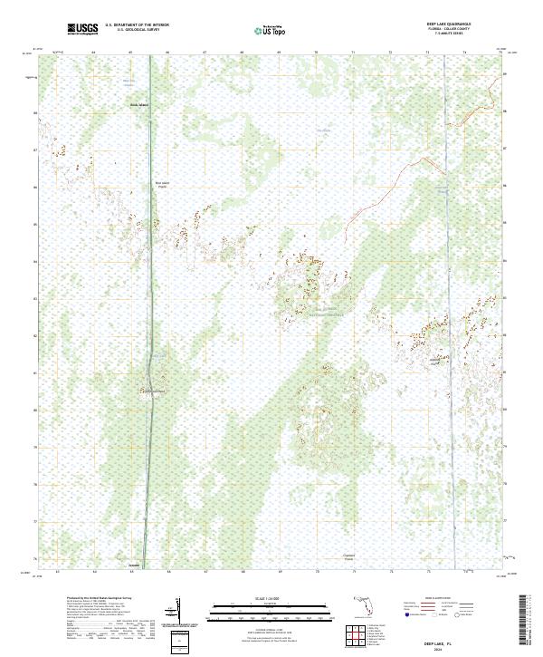
2024 Map of Deep Lake
USGS Topo · Published 2024About this map
Big Cypress National Preserve encompasses the majority of this landscape, where the flat topography is defined by a mosaic of wet prairies and hardwood hammocks. The settlement of Jerome sits at the southern edge, connected to the interior via a north-south roadway that passes through Hollywood Head and skirts the eponymous Deep Lake. This area reflects the unique hydrological patterns of the Everglades ecosystem, where slightly elevated features like Rock Island stand out against the broad expanses of Rock Island Prairie and Miles City Prairie.
Find a feature on this map
17 named features on this map. Tap any name to fly to it.
Don’t see what you’re looking for? This feature index may not catch every label — zoom into the map to look around manually.
Map Details
Editions of this 2024 Deep Lake Map
This is the sole edition of this map. No revisions or reprints were ever made.
Other maps of this area

1956 · Miami
USGS Topo · 1:250,000

1956 · West Palm Beach
USGS Topo · 1:250,000

1957 · West Palm Beach
USGS Topo · 1:250,000

1958 · West Palm Beach
USGS Topo · 1:250,000

1958 · Miami
USGS Topo · 1:250,000

1958 · Catherine Island
USGS Topo · 1:24,000

1959 · Miles City
USGS Topo · 1:24,000

1959 · Deep Lake
USGS Topo · 1:24,000

1959 · Deep Lake SW
USGS Topo · 1:24,000
1962 · Catherine Island
USGS Topo · 1:24,000