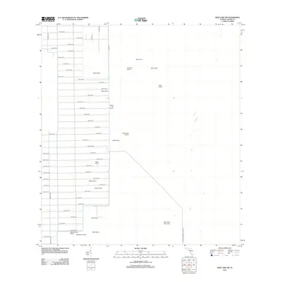
2012 Map of Deep Lake SW
USGS Topo · Published 2012About this map
Twelvemile Prairie and West Prairie define this portion of the Florida Everglades, where a vast network of numbered avenues and boulevards push east into the wetlands of Collier County. The map captures an era of grid-based expansion meeting the ancient, slow-drained terrain of Royal Palm Hammock and Doe Prairie. While the western half is dominated by the geometric layout of Merritt Blvd and dozens of residential-scale avenues, the eastern expanse remains largely open. This intersection of human planning and natural hydrology is evident in the placement of roads terminating abruptly at the edge of Buck Prairie and Turkey Prairie. Local history is preserved in the evocative names of these prairies, including Starvation Prairie and Burnt Flat Prairie, suggesting the early challenges of navigating and settling this seasonally saturated landscape near Slate Prairie.
Find a feature on this map
57 named features on this map. Tap any name to fly to it.
Don’t see what you’re looking for? This feature index may not catch every label — zoom into the map to look around manually.
Map Details
Editions of this 2012 Deep Lake SW Map
This is the sole edition of this map. No revisions or reprints were ever made.
Other maps of this area

1956 · Miami
USGS Topo · 1:250,000

1956 · West Palm Beach
USGS Topo · 1:250,000

1957 · West Palm Beach
USGS Topo · 1:250,000

1958 · West Palm Beach
USGS Topo · 1:250,000

1958 · Miami
USGS Topo · 1:250,000

1958 · Catherine Island
USGS Topo · 1:24,000

1958 · Belle Meade NE
USGS Topo · 1:24,000

1958 · Belle Meade SE
USGS Topo · 1:24,000

1959 · Miles City
USGS Topo · 1:24,000

1959 · Deep Lake
USGS Topo · 1:24,000