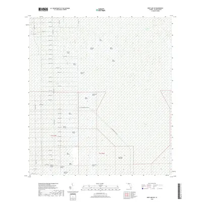
2018 Map of Deep Lake SW
USGS Topo · Published 2018About this map
Royal Palm Hammock anchors the southeastern reaches of this landscape, where the vast wetlands of Collier County are defined by a rhythmic sequence of named prairies and strands. The map documents a transition from the dense swamp of the Fakahatchee Strand and Picayune Strand into open, ecologically distinct areas like Twelvemile Prairie and Soft Prairie. This 2018 survey reveals a grid of roads extending into the wilderness, such as Patterson Blvd and Merritt Blvd, which terminate abruptly as they meet the natural boundaries of the wetlands. Named features like Pretty Island and Dan House Prairie suggest a history of local navigation and land usage in a region where dry ground is a precious commodity. The nomenclature, featuring descriptive labels like Starvation Prairie and Burnt Flat Prairie, reflects the stark realities of the South Florida interior.
Find a feature on this map
63 named features on this map. Tap any name to fly to it.
Don’t see what you’re looking for? This feature index may not catch every label — zoom into the map to look around manually.
Map Details
Editions of this 2018 Deep Lake SW Map
This is the sole edition of this map. No revisions or reprints were ever made.
Other maps of this area

1956 · Miami
USGS Topo · 1:250,000

1956 · West Palm Beach
USGS Topo · 1:250,000

1957 · West Palm Beach
USGS Topo · 1:250,000

1958 · West Palm Beach
USGS Topo · 1:250,000

1958 · Miami
USGS Topo · 1:250,000

1958 · Catherine Island
USGS Topo · 1:24,000

1958 · Belle Meade NE
USGS Topo · 1:24,000

1958 · Belle Meade SE
USGS Topo · 1:24,000

1959 · Miles City
USGS Topo · 1:24,000

1959 · Deep Lake
USGS Topo · 1:24,000