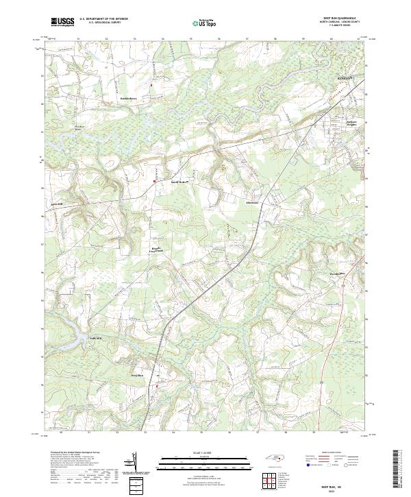
2022 Map of Deep Run
USGS Topo · Published 2022About this map
Deep Run anchors the southern portion of this Lenoir County landscape, where the coastal plain is defined by the winding course of the Neuse River and its numerous tributaries. This modern survey illustrates a rural geography still organized around historic intersections and small community hubs like Blands Crossroads, Sandy Bottom, and Albrittons. The presence of Tulls Mill and Woodington suggests a long-standing settlement pattern tied to the local watercourses, specifically Southwest Creek and its various branches such as Hornpipe Br and Turkey Br.
Find a feature on this map
95 named features on this map. Tap any name to fly to it.
Don’t see what you’re looking for? This feature index may not catch every label — zoom into the map to look around manually.
Map Details
Editions of this 2022 Deep Run Map
This is the sole edition of this map. No revisions or reprints were ever made.
Other maps of this area

1914 · Kinston
USGS Topo · 1:48,000

1916 · Kinston
USGS Topo · 1:62,500

1953 · Rocky Mount
USGS Topo · 1:250,000

1954 · Rocky Mount
USGS Topo · 1:250,000

1957 · Goldsboro
USGS Topo · 1:62,500

1957 · Seven Springs
USGS Topo · 1:62,500

1958 · Deep Run
USGS Topo · 1:62,500

1980 · Seven Springs
USGS Topo · 1:24,000
1980 · Pink Hill
USGS Topo · 1:24,000
1980 · Deep Run
USGS Topo · 1:24,000