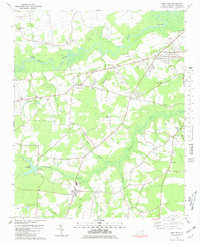
1980 Map of Deep Run
USGS Topo · Published 1981About this map
The Neuse River winds through this coastal plain landscape, defining a region of North Carolina marked by small tobacco-farming settlements and a dense network of blackwater creeks. The community of Deep Run serves as a southern hub, supported by local institutions like South Lenoir High Sch and several family-named landmarks such as Whaley and Cauley. To the west, the waters of Southwest Creek are gathered at Tulls Millpond, the site of Tulls Mill, illustrating the early industrial reliance on these slow-moving drainage systems.
Find a feature on this map
52 named features on this map. Tap any name to fly to it.
Don’t see what you’re looking for? This feature index may not catch every label — zoom into the map to look around manually.
Map Details
Editions of this 1980 Deep Run Map
This is the sole edition of this map. No revisions or reprints were ever made.
Other maps of this area

1914 · Kinston
USGS Topo · 1:48,000

1916 · Kinston
USGS Topo · 1:62,500

1953 · Rocky Mount
USGS Topo · 1:250,000

1954 · Rocky Mount
USGS Topo · 1:250,000

1957 · Goldsboro
USGS Topo · 1:62,500

1957 · Seven Springs
USGS Topo · 1:62,500

1958 · Deep Run
USGS Topo · 1:62,500

1980 · Seven Springs
USGS Topo · 1:24,000
1980 · Pink Hill
USGS Topo · 1:24,000
1980 · Rivermont
USGS Topo · 1:24,000