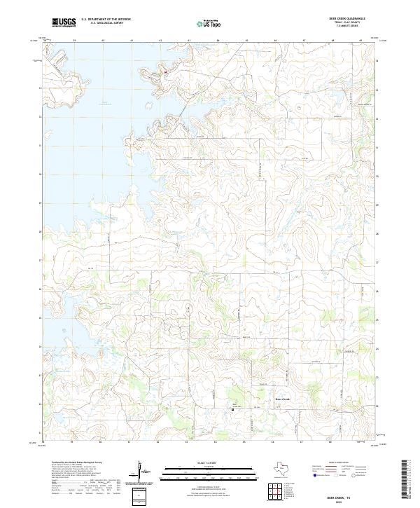
2022 Map of Deer Creek
USGS Topo · Published 2022About this map
Lake Arrowhead dominates the northern reaches of this Clay County landscape, where numerous inlets and points are defined by a network of winding roads like Bunny Run and Penobscot Trl. The southern portion of the quadrangle shifts toward a traditional rural layout centered on the community of Deer Creek. This area preserves significant local history at the Deer Creek Cem, situated near the intersection of FM 1883 and Brixey Rd. The terrain is shaped by the drainage patterns of the Dry Fork Little Wichita River and the smaller Deer Cr, which feed several private water bodies including W I Howard Lake and Berend Lake. The transition from the developed lakeshore to the established agricultural plots around Deer Creek illustrates the contemporary land use of north-central Texas.
Find a feature on this map
40 named features on this map. Tap any name to fly to it.
Don’t see what you’re looking for? This feature index may not catch every label — zoom into the map to look around manually.
Map Details
Editions of this 2022 Deer Creek Map
This is the sole edition of this map. No revisions or reprints were ever made.
Other maps of this area

1954 · Wichita Falls
USGS Topo · 1:250,000

1956 · Sloop Creek
USGS Topo · 1:24,000

1956 · Henrietta
USGS Topo · 1:62,500

1957 · Wichita Falls East
USGS Topo · 1:62,500

1958 · Wichita Falls
USGS Topo · 1:250,000

1962 · Windthorst
USGS Topo · 1:24,000

1963 · Deer Creek
USGS Topo · 1:24,000

1963 · Scotland
USGS Topo · 1:24,000

1964 · Scotland SE
USGS Topo · 1:24,000
1964 · Joy
USGS Topo · 1:24,000