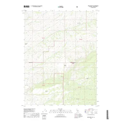
2018 Map of Deer Creek Flat
USGS Topo · Published 2018About this map
Deer Creek and its complex network of seasonal drainages define this portion of the Lassen National Forest in Tehama County. The landscape is characterized by its numerous named flats and coves, such as Deer Creek Flat, Digger Pine Flat, Morris Flat, and Moak Cove, which suggest the historic importance of these rare level areas for staging or settlement within the steep drainages. The Forest Service and Usgs detail a terrain carved by water, where Big Dry Cr and Little Dry Cr meet the larger flow of the creek. Distinctive landmarks like Steamboat Rock and the high point of Brushy Mtn provided navigational anchors for early travelers through these foothills. The map also traces the origins of various forks, including the N Fork Singer Cr and S Fork Singer Cr at the southern edge of the survey.
Find a feature on this map
28 named features on this map. Tap any name to fly to it.
Don’t see what you’re looking for? This feature index may not catch every label — zoom into the map to look around manually.
Map Details
Editions of this 2018 Deer Creek Flat Map
This is the sole edition of this map. No revisions or reprints were ever made.
Other maps of this area

1886 · Lassen Peak
USGS Topo · 1:250,000

1891 · Chico
USGS Topo · 1:125,000

1892 · Lassen Peak
USGS Topo · 1:250,000

1893 · Chico
USGS Topo · 1:125,000

1894 · Lassen Peak
USGS Topo · 1:250,000

1895 · Chico
USGS Topo · 1:125,000

1912 · Singer Creek
USGS Topo · 1:31,680

1935 · Paynes Creek
USGS Topo · 1:96,000

1941 · Mineral
USGS Topo · 1:125,000

1944 · Richardson Springs
USGS Topo · 1:62,500