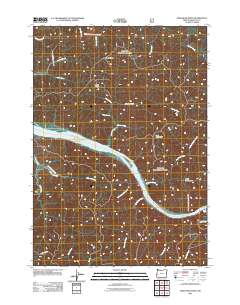
2011 Map of Deer Head Point
USGS Topo · Published 2011About this map
The Umpqua River snakes through this portion of Douglas County, defining the geography around Deer Head Point. This 2011 survey captures a landscape of steep timbered ridges and deep canyons, where the river widens around Echo Island and flows past the landmark Brandy Bar. The terrain is characterized by prominent elevations such as Skagit Ridge and Lunch Ridge, which overlook a dense network of tributaries including Johnson Creek and Harvey Creek. Human presence is marked by a handful of remote access routes like Johanneson Creek Rd and Dean Ridge Rd, serving the timber and recreation interests along the river corridor. To the east, the dramatic topography drops into Devils Club Canyon, illustrating the complex drainage patterns that feed into the Umpqua system.
Find a feature on this map
29 named features on this map. Tap any name to fly to it.
Don’t see what you’re looking for? This feature index may not catch every label — zoom into the map to look around manually.
Map Details
Editions of this 2011 Deer Head Point Map
This is the sole edition of this map. No revisions or reprints were ever made.
Other maps of this area

1919 · Earl
USGS Topo · 1:48,000

1920 · Siltcoos Lake
USGS Topo · 1:62,500

1923 · Reedsport
USGS Topo · 1:62,500

1941 · Siltcoos Lake
USGS Topo · 1:62,500

1942 · Siltcoos Lake
USGS Topo · 1:62,500

1942 · Reedsport
USGS Topo · 1:62,500

1943 · Goodwin Peak
USGS Topo · 1:62,500

1954 · Coos Bay
USGS Topo · 1:250,000

1955 · Scottsburg
USGS Topo · 1:62,500
1956 · Reedsport
USGS Topo · 1:62,500