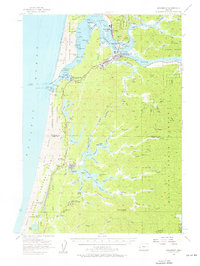
1956 Map of Reedsport
USGS Topo · Published 1956About this map
The Umpqua River dominates this coastal landscape, serving as the central artery for the timber and maritime economies of Reedsport and Gardiner. In the mid-1950s, the riverfront is characterized by industrial activity, including a prominent Sawmill and the tracks of the Southern Pacific railroad winding along the northern bank. The town of Winchester Bay sits near the river's mouth, adjacent to the Coast Guard Res and the lighthouse within Umpqua Lighthouse State Park. To the south, the terrain transitions into the freshwater complex of North Tenmile Lake and Tenmile Lake, where the community of Lakeside and points like Shutter Landing indicate a shift toward recreational and residential development. Further south, the North Bend Air Force Station represents a Cold War-era military footprint within the dunes of the Siuslaw National Forest.
Find a feature on this map
90 named features on this map. Tap any name to fly to it.
Don’t see what you’re looking for? This feature index may not catch every label — zoom into the map to look around manually.
Map Details
Editions of this 1956 Reedsport Map
3 editions found
Other maps of this area

1896 · Coos Bay
USGS Topo · 1:125,000

1898 · Coos Bay
USGS Topo · 1:125,000

1900 · Coos Bay
USGS Topo · 1:125,000

1919 · Earl
USGS Topo · 1:48,000

1920 · Siltcoos Lake
USGS Topo · 1:62,500

1923 · Reedsport
USGS Topo · 1:62,500

1928 · Sitkum
USGS Topo · 1:125,000

1941 · Siltcoos Lake
USGS Topo · 1:62,500

1942 · Siltcoos Lake
USGS Topo · 1:62,500

1942 · Reedsport
USGS Topo · 1:62,500