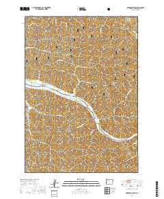
2020 Map of Deer Head Point
USGS Topo · Published 2020About this map
The Umpqua River carves a dominant path through this portion of Douglas County, defining the local geography with its sharp meanders and landmarks like Echo Island and Brandy Bar. Much of the northern terrain is managed as part of the Siuslaw National Forest, where steep drainage systems such as Devils Club Canyon and numerous creeks like Indian Charlie Cr and Charlotte Cr feed into the main river valley. This 2020 survey illustrates the modern configuration of the forest access roads, including Johanneson Creek Rd and Loon Lake Rd, which navigate the high ground of Skagit Ridge and Umpcoos Ridge. The map provides a contemporary view of this timber-rich landscape, noting topographical features like Lunch Ridge and Deer Head Point that have long served as markers for river navigation and forest management.
Find a feature on this map
39 named features on this map. Tap any name to fly to it.
Don’t see what you’re looking for? This feature index may not catch every label — zoom into the map to look around manually.
Map Details
Editions of this 2020 Deer Head Point Map
This is the sole edition of this map. No revisions or reprints were ever made.
Other maps of this area

1919 · Earl
USGS Topo · 1:48,000

1920 · Siltcoos Lake
USGS Topo · 1:62,500

1923 · Reedsport
USGS Topo · 1:62,500

1941 · Siltcoos Lake
USGS Topo · 1:62,500

1942 · Siltcoos Lake
USGS Topo · 1:62,500

1942 · Reedsport
USGS Topo · 1:62,500

1943 · Goodwin Peak
USGS Topo · 1:62,500

1954 · Coos Bay
USGS Topo · 1:250,000

1955 · Scottsburg
USGS Topo · 1:62,500
1956 · Reedsport
USGS Topo · 1:62,500