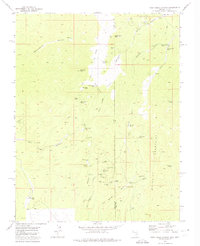
1972 Map of Deer Lodge Canyon
USGS Topo · Published 1975About this map
Deer Lodge stands as a focal point in this 1970s survey of the high desert along the Nevada Utah border. The landscape is heavily defined by its mining history, with a high concentration of named claims and shafts such as the Johnny Mine, Homestake Mine, and Etna Mine scattered through the Paradise Mountains. This era shows a complex network of resource extraction and transit, evidenced by numerous jeep trails and the Fay Midnight Trail connecting remote sites like Gold Springs to the wider valley.
Find a feature on this map
53 named features on this map. Tap any name to fly to it.
Don’t see what you’re looking for? This feature index may not catch every label — zoom into the map to look around manually.
Map Details
Editions of this 1972 Deer Lodge Canyon Map
This is the sole edition of this map. No revisions or reprints were ever made.
Other maps of this area

1885 · St. George
USGS Topo · 1:250,000

1885 · Pioche
USGS Topo · 1:250,000

1886 · Pioche
USGS Topo · 1:250,000

1891 · St. George
USGS Topo · 1:250,000

1953 · Richfield
USGS Topo · 1:250,000

1953 · Cedar City
USGS Topo · 1:250,000

1954 · Caliente
USGS Topo · 1:250,000

1956 · Lund
USGS Topo · 1:250,000

1958 · Richfield
USGS Topo · 1:250,000

1958 · Cedar City
USGS Topo · 1:250,000