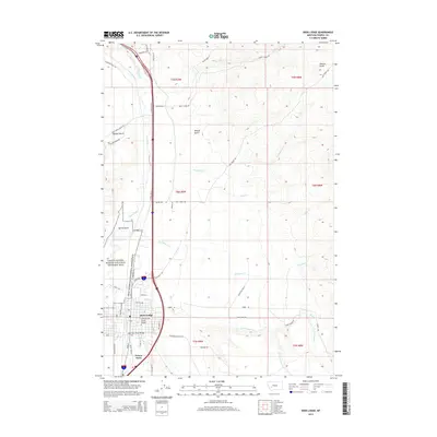
2014 Map of Deer Lodge
USGS Topo · Published 2014About this map
Deer Lodge serves as the focal point of this Powell County region, situated along the valley of the Clark Fork river. The landscape is defined by the transition from the river bottom lands to the rising drainages of Mullan Gulch and Helena Gulch. A significant portion of the riverfront is occupied by the Grant-Kohrs Ranch National Historic Site, preserving the legacy of the open-range cattle era. To the south of the city, the presence of the Prison Farm indicates the long-standing local integration of institutional agriculture and the state correctional system. The map details a network of vital mountain-fed waterways, including Cottonwood Cr, Fred Burr Cr, and Tin Cup Joe Cr, which have historically supported both the ranching operations and the town's development. Local infrastructure is highlighted by features such as the Clark Fork River Bridge and the Cottonwood Creek Bridge.
Find a feature on this map
55 named features on this map. Tap any name to fly to it.
Don’t see what you’re looking for? This feature index may not catch every label — zoom into the map to look around manually.
Map Details
Editions of this 2014 Deer Lodge Map
This is the sole edition of this map. No revisions or reprints were ever made.
Other maps of this area

1889 · Helena
USGS Topo · 1:250,000

1893 · Helena
USGS Topo · 1:250,000

1899 · Helena
USGS Topo · 1:250,000

1903 · Helena
USGS Topo · 1:250,000

1947 · Butte
USGS Topo · 1:250,000

1958 · Butte
USGS Topo · 1:250,000

1958 · Avon
USGS Topo · 1:62,500

1958 · Garrison
USGS Topo · 1:62,500

1959 · Deer Lodge
USGS Topo · 1:62,500

1960 · Butte
USGS Topo · 1:250,000