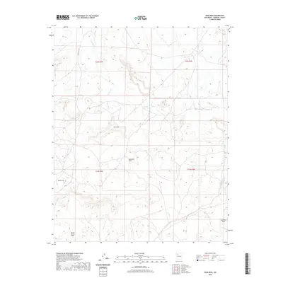
2020 Map of Deer Mesa
USGS Topo · Published 2020About this map
Deer Mesa and Sisnathyel Mesa define this high-altitude landscape in the Eastern Navajo Agency, where complex drainage systems cut through the sedimentary layers of Sandoval County. The map details a network of ephemeral watercourses, most notably Tancosa Wash and Peña Wash in the north, and Torreon Wash as it winds toward the southeast. These arroyos and washes are critical markers of the local topography, influencing the placement of early transportation routes like Indian Svc Rte 23 and Pilon.
Find a feature on this map
18 named features on this map. Tap any name to fly to it.
Don’t see what you’re looking for? This feature index may not catch every label — zoom into the map to look around manually.
Map Details
Editions of this 2020 Deer Mesa Map
This is the sole edition of this map. No revisions or reprints were ever made.
Other maps of this area

1883 · Mt. Taylor
USGS Topo · 1:250,000

1886 · Mt. Taylor
USGS Topo · 1:250,000

1889 · Largo
USGS Topo · 1:250,000

1892 · Mt. Taylor
USGS Topo · 1:250,000

1895 · Largo
USGS Topo · 1:250,000

1899 · Mt. Taylor
USGS Topo · 1:250,000

1954 · Aztec
USGS Topo · 1:250,000

1958 · Aztec
USGS Topo · 1:250,000

1958 · Albuquerque
USGS Topo · 1:250,000
1961 · Ojo Encino Mesa
USGS Topo · 1:24,000