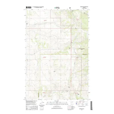
2017 Map of Deer Park
USGS Topo · Published 2017About this map
Sixteenmile Cr winds through the southern reaches of this landscape, carving the prominent Sixteenmile Canyon along the boundary between Broadwater and Gallatin counties. The terrain is defined by a dense network of drainages and springs, including Farley Spring and A-Frame Spring, which feed into numerous named gulches like Miners Gulch and Sawmill Gulch. These names suggest a history of resource extraction and seasonal industry within the timbered slopes of the Helena National Forest. Small settlements such as Cedar Hollow and Deer Park provide isolated points of habitation connected by a primitive road network, including Dry Creek Rd and Sixteen Mile Rd. The mapping reveals a transition from forested uplands to the structured canyon floor, where the convergence of creek and road defines the local geography.
Find a feature on this map
36 named features on this map. Tap any name to fly to it.
Don’t see what you’re looking for? This feature index may not catch every label — zoom into the map to look around manually.
Map Details
Editions of this 2017 Deer Park Map
This is the sole edition of this map. No revisions or reprints were ever made.
Other maps of this area

1886 · Fort Logan
USGS Topo · 1:250,000

1948 · White Sulphur Springs
USGS Topo · 1:250,000

1949 · Maudlow
USGS Topo · 1:62,500

1949 · Toston
USGS Topo · 1:62,500

1950 · Duck Creek Pass
USGS Topo · 1:62,500

1958 · White Sulphur Springs
USGS Topo · 1:250,000

1961 · White Sulphur Springs
USGS Topo · 1:250,000

1965 · White Sulphur Springs
USGS Topo · 1:250,000
1971 · Sulphur Bar Creek
USGS Topo · 1:24,000

1976 · Townsend
USGS Topo · 1:100,000