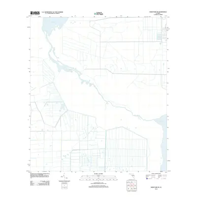
2012 Map of Deer Park NE
USGS Topo · Published 2012About this map
The Saint Johns River defines the landscape of this Central Florida corridor, winding through a complex system of marshes and managed waterways between Lake Winder and Lake Washington. This 2012 survey reveals an extensive grid of drainage canals and agricultural boundaries typical of the region's land use patterns, where water management is central to the terrain. Tributaries like Wolf Cr and Pennywash Cr feed into the river system, highlighting the natural hydrology that persists alongside human-engineered irrigation channels. The map serves as a record of the shifting water levels and the environmental structure of the upper river basin at the start of the 21st century.
Find a feature on this map
5 named features on this map. Tap any name to fly to it.
Don’t see what you’re looking for? This feature index may not catch every label — zoom into the map to look around manually.
Map Details
Editions of this 2012 Deer Park NE Map
This is the sole edition of this map. No revisions or reprints were ever made.
Other maps of this area

1949 · Melbourne West
USGS Topo · 1:24,000

1949 · Eau Gallie
USGS Topo · 1:24,000

1949 · Cocoa
USGS Topo · 1:24,000

1951 · Eau Gallie
USGS Topo · 1:24,000

1951 · Cocoa
USGS Topo · 1:24,000

1951 · Melbourne West
USGS Topo · 1:24,000

1953 · Lake Poinsett
USGS Topo · 1:24,000

1953 · Deer Park NE
USGS Topo · 1:24,000

1953 · Deer Park SE
USGS Topo · 1:24,000

1953 · Deer Park NW
USGS Topo · 1:24,000