
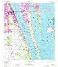
1949 Map of Cocoa
USGS Topo · Published 1962About this map
Cocoa and Rockledge anchor the western shore of the Indian River in this late 1940s survey, showing the riverside development that followed the Florida East Coast railroad and the Dixie Highway. Across the water, Merritt Island remains largely agricultural and undeveloped compared to its modern-day character, though a central Causeway already links the island to the mainland at the Cocoa Yacht Basin. To the east, the Banana River is flanked by the long reach of Horti Point and several smaller settlements like Georgiana, Angel City, and Fairyland. This hydrographic and topographic study captures the intricate network of the Intracoastal Waterway and various small island clusters such as Shortys Banks and Big Island before the region was transformed by the growth of the nearby aerospace industry.
Find a feature on this map
41 named features on this map. Tap any name to fly to it.
Don’t see what you’re looking for? This feature index may not catch every label — zoom into the map to look around manually.
Map Details
Editions of this 1949 Cocoa Map
2 editions found
Other maps of this area

1949 · Courtenay
USGS Topo · 1:24,000

1949 · Eau Gallie
USGS Topo · 1:24,000

1949 · Sharpes
USGS Topo · 1:24,000

1949 · Cocoa Beach
USGS Topo · 1:24,000

1949 · Tropic
USGS Topo · 1:24,000

1951 · Eau Gallie
USGS Topo · 1:24,000

1951 · Cocoa
USGS Topo · 1:24,000

1951 · Courtenay
USGS Topo · 1:24,000

1951 · Sharpes
USGS Topo · 1:24,000
1951 · Cocoa Beach
USGS Topo · 1:24,000