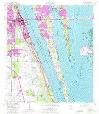
1949 Map of Cocoa
USGS Topo · Published 1970About this map
Merritt Island sits at the heart of this mid-century coastal landscape, flanked by the broad waters of the Indian River and the Banana River. The urban development of Cocoa and Rockledge is documented in detail, showing a period of significant growth along the Florida East Coast rail corridor and the Intracoastal Waterway. This survey, based on 1948 topography with 1970 photorevisions, captures the area just as the space-age expansion began to reshape Brevard County.
Find a feature on this map
36 named features on this map. Tap any name to fly to it.
Don’t see what you’re looking for? This feature index may not catch every label — zoom into the map to look around manually.
Map Details
Editions of this 1949 Cocoa Map
2 editions found
Other maps of this area

1949 · Courtenay
USGS Topo · 1:24,000

1949 · Eau Gallie
USGS Topo · 1:24,000

1949 · Sharpes
USGS Topo · 1:24,000

1949 · Cocoa
USGS Topo · 1:24,000

1949 · Cocoa Beach
USGS Topo · 1:24,000

1949 · Tropic
USGS Topo · 1:24,000

1951 · Eau Gallie
USGS Topo · 1:24,000

1951 · Cocoa
USGS Topo · 1:24,000

1951 · Courtenay
USGS Topo · 1:24,000

1951 · Sharpes
USGS Topo · 1:24,000