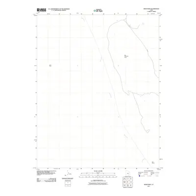
2011 Map of Deer Point
USGS Topo · Published 2011About this map
Big Thomson Mesa dominates the central landscape of this Garfield County quadrangle, a testament to the dramatic verticality of the southern Utah desert. The winding path of Burr Trl provides a critical historical and modern corridor through this high-plateau terrain, descending toward the lower drainage basins. This area is defined by its seasonal hydrology, where Halls Creek carves a path through the sandstone, supported by isolated water sources like Clay Seep in the northern reaches. The topographical layout near Deer Point and Hall Divide illustrates the complex drainage and erosion patterns typical of this region, providing essential spatial data for those studying the physical geography of the Colorado Plateau at the beginning of the twenty-first century.
Find a feature on this map
6 named features on this map. Tap any name to fly to it.
Don’t see what you’re looking for? This feature index may not catch every label — zoom into the map to look around manually.
Map Details
Editions of this 2011 Deer Point Map
This is the sole edition of this map. No revisions or reprints were ever made.
Other maps of this area

1886 · Escalante
USGS Topo · 1:250,000

1886 · Henry Mountains
USGS Topo · 1:250,000

1892 · Henry Mountains
USGS Topo · 1:250,000

1953 · Mt Pennell
USGS Topo · 1:62,500

1953 · Circle Cliffs 1 SE
USGS Topo · 1:24,000

1953 · Mt Pennell 2 SE
USGS Topo · 1:24,000

1953 · Mt Pennell 3 NW
USGS Topo · 1:24,000

1953 · Mt Pennell 3 SW
USGS Topo · 1:24,000

1953 · Mt Pennell 2 SW
USGS Topo · 1:24,000

1953 · Circle Cliffs 4 NE
USGS Topo · 1:24,000