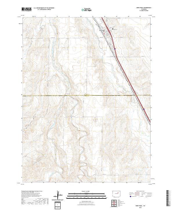
2022 Map of Deer Trail
USGS Topo · Published 2022About this map
Deer Trail serves as the primary hub of this high-plains landscape, situated along a prominent north-south transportation corridor. The town's grid is detailed with specific streets like Date St, 2nd Ave, and Cedar St, while the local history of the community is anchored by Evergreen Cem to the northeast. The geography is defined by a network of ephemeral watercourses and deep-cut drainages that characterize the eastern Colorado prairie. The expansive drainage of Middle Bijou Cr dominates the central portion of the map, flanked by numerous topographical features such as Hay Gulch, Willow Gulch, and Station Gulch. The boundary between Arapahoe Co and Elbert Co bisects the southern half of the quadrangle, illustrating the rural connectivity maintained by a system of section-line roads like Bartlett Rd and Co Rd 129.
Find a feature on this map
42 named features on this map. Tap any name to fly to it.
Don’t see what you’re looking for? This feature index may not catch every label — zoom into the map to look around manually.
Map Details
Editions of this 2022 Deer Trail Map
This is the sole edition of this map. No revisions or reprints were ever made.
Other maps of this area

1891 · Limon
USGS Topo · 1:125,000

1892 · Limon
USGS Topo · 1:125,000

1953 · Denver
USGS Topo · 1:250,000

1954 · Limon
USGS Topo · 1:250,000

1956 · Peoria
USGS Topo · 1:24,000

1956 · Byers
USGS Topo · 1:24,000

1957 · Denver
USGS Topo · 1:250,000

1957 · Limon
USGS Topo · 1:250,000

1958 · Limon
USGS Topo · 1:250,000

1958 · Denver
USGS Topo · 1:250,000