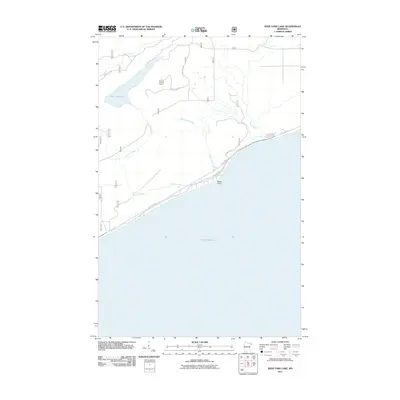
2011 Map of Deer Yard Lake
USGS Topo · Published 2011About this map
The rocky northern shore of Lake Superior dominates this portion of Cook County, where the boreal landscape is defined by the descent of multiple waterways toward the Great Lake. The Cascade River and its accompanying Cascade Falls serve as major landmarks in the eastern section, while the interior is dotted with significant water bodies like Deer Yard Lake and several drainage systems including Indian Camp Creek and Spruce Creek. The infrastructure here reflects a managed forest environment, with the Cascade Lookout Tower positioned as a highpoint for observation above a network of timber and access routes such as Ward Lake Rd and Forest Rte 159. Along the coast, State Hwy 61 and Cascade Beach Rd trace the shoreline near Black Point, marking the primary corridor for travel through this wooded coastal region.
Find a feature on this map
15 named features on this map. Tap any name to fly to it.
Don’t see what you’re looking for? This feature index may not catch every label — zoom into the map to look around manually.
Map Details
Editions of this 2011 Deer Yard Lake Map
This is the sole edition of this map. No revisions or reprints were ever made.
Other maps of this area

1919 · Brule Lake
USGS Topo · 1:62,500

1919 · Grand Marais
USGS Topo · 1:62,500

1919 · Lutsen
USGS Topo · 1:62,500

1954 · Two Harbors
USGS Topo · 1:250,000

1957 · Two Harbors
USGS Topo · 1:250,000

1958 · Two Harbors
USGS Topo · 1:250,000

1958 · Deer Yard Lake
USGS Topo · 1:24,000

1958 · Good Harbor Bay
USGS Topo · 1:24,000

1959 · Lutsen
USGS Topo · 1:24,000

1960 · Tait Lake
USGS Topo · 1:24,000