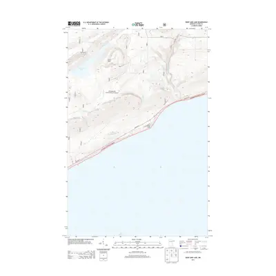
2013 Map of Deer Yard Lake
USGS Topo · Published 2013About this map
Deer Yard Lake and the surrounding Superior National Forest define this landscape along the North Shore of Lake Superior. The terrain is marked by sharp elevation drops toward the lake, where the Cascade River flows past Cascade Falls to its mouth. Strategic vantage points like the Cascade Lookout Tower overlook a network of forest routes, including Ward Lake Rd and Forest Rte 159. Coastal access is concentrated along State Hwy 61 and Cascade Beach Rd, tracing the shoreline near Black Point. The drainage patterns of Murmur Cr and Indian Camp Cr illustrate the complex watershed of this wilderness area in the early 21st century.
Find a feature on this map
13 named features on this map. Tap any name to fly to it.
Don’t see what you’re looking for? This feature index may not catch every label — zoom into the map to look around manually.
Map Details
Editions of this 2013 Deer Yard Lake Map
This is the sole edition of this map. No revisions or reprints were ever made.
Other maps of this area

1919 · Brule Lake
USGS Topo · 1:62,500

1919 · Grand Marais
USGS Topo · 1:62,500

1919 · Lutsen
USGS Topo · 1:62,500

1954 · Two Harbors
USGS Topo · 1:250,000

1957 · Two Harbors
USGS Topo · 1:250,000

1958 · Two Harbors
USGS Topo · 1:250,000

1958 · Deer Yard Lake
USGS Topo · 1:24,000

1958 · Good Harbor Bay
USGS Topo · 1:24,000

1959 · Lutsen
USGS Topo · 1:24,000

1960 · Tait Lake
USGS Topo · 1:24,000