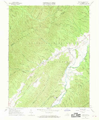
1967 Map of Deerfield
USGS Topo · Published 1968About this map
Deerfield Valley serves as a narrow corridor of cultivation and settlement between the high ridges of the George Washington National Forest in the late 1960s. The settlement of Deerfield anchors the valley along the Calfpasture River, where the landscape is dotted with small communities like Fridley and Little Baltimore. This survey is particularly useful for identifying rural landmarks of the era, including the Rocky Spring Ch and the Mt Mary Cem, as well as identifying the specific farm fence and field lines that were visible from aerial photography in 1964.
Find a feature on this map
78 named features on this map. Tap any name to fly to it.
Don’t see what you’re looking for? This feature index may not catch every label — zoom into the map to look around manually.
Map Details
Editions of this 1967 Deerfield Map
4 editions found
Other maps of this area

1894 · Staunton
USGS Topo · 1:125,000

1901 · Monterey
USGS Topo · 1:125,000

1924 · Mc Dowell
USGS Topo · 1:62,500

1941 · Monterey
USGS Topo · 1:62,500

1943 · Craigsville
USGS Topo · 1:62,500

1944 · Monterey
USGS Topo · 1:62,500

1944 · Mc Dowell
USGS Topo · 1:62,500

1945 · Craigsville
USGS Topo · 1:62,500

1946 · Mc Dowell
USGS Topo · 1:62,500

1946 · Williamsville
USGS Topo · 1:62,500