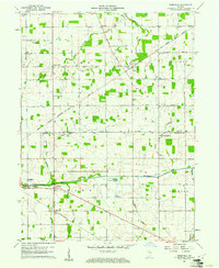
1960 Map of Deerfield
USGS Topo · Published 1961About this map
The Old Indian Treaty Boundary slices diagonally across this rural landscape, a persistent surveyor's line that continues to dictate the orientation of local roads and property divisions. This 1960 field check reveals a community anchored by the Mississinewa River and the Little Salamonie River, where small settlements like Deerfield and Randolph sit at the intersection of a steady grid of county roads and the Pennsylvania railroad line.
Find a feature on this map
36 named features on this map. Tap any name to fly to it.
Don’t see what you’re looking for? This feature index may not catch every label — zoom into the map to look around manually.
Map Details
Editions of this 1960 Deerfield Map
This is the sole edition of this map. No revisions or reprints were ever made.
Other maps of this area

1915 · Fort Recovery
USGS Topo · 1:48,000

1916 · Winchester
USGS Topo · 1:48,000

1918 · Winchester
USGS Topo · 1:62,500

1918 · Fort Recovery
USGS Topo · 1:62,500

1943 · Winchester
USGS Topo · 1:62,500

1952 · Maxville
USGS Topo · 1:24,000

1953 · Muncie
USGS Topo · 1:250,000

1956 · Muncie
USGS Topo · 1:250,000

1960 · Union City
USGS Topo · 1:24,000

1960 · Fort Recovery
USGS Topo · 1:24,000