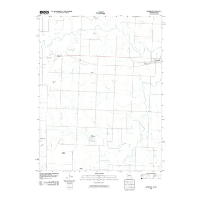
2009 Map of Deerfield
USGS Topo · Published 2009About this map
The Marmaton River meanders across this rural landscape near the Kansas-Missouri border, defining a region where water management and agriculture are central to the terrain. Notable hydraulic features include the Seitz Lake Dam and the Doctor R F Searl Dam, reflecting a landscape engineered for local utility. The settlement pattern is characterized by small clusters such as Eve, Katy, Swart, and the township of Deerfield, many of which grew alongside the rail-corridor geometry that dictates the road network. For genealogists, the map preserves several rural burial sites, including Coleman Cemetery, Cox Cemetery, and Logan Cemetery. Elevation points like Vetters Hill and Vergil Mound provide the few breaks in the low-lying drainage basins of Grassy Run and Dry Wood Creek, illustrating the subtle topography of Vernon County.
Find a feature on this map
24 named features on this map. Tap any name to fly to it.
Don’t see what you’re looking for? This feature index may not catch every label — zoom into the map to look around manually.
Map Details
Editions of this 2009 Deerfield Map
This is the sole edition of this map. No revisions or reprints were ever made.
Other maps of this area

1884 · Fort Scott
USGS Topo · 1:125,000

1886 · Nevada
USGS Topo · 1:125,000

1886 · Fort Scott
USGS Topo · 1:125,000

1893 · Fort Scott
USGS Topo · 1:125,000

1894 · Nevada
USGS Topo · 1:125,000

1938 · Metz
USGS Topo · 1:24,000

1939 · Metz
USGS Topo · 1:24,000

1939 · Deerfield
USGS Topo · 1:24,000

1939 · Moundville
USGS Topo · 1:24,000

1942 · Richards
USGS Topo · 1:24,000