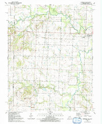
1991 Map of Deerfield
USGS Topo · Published 1991About this map
The Marmaton River and Dry Wood Creek define the drainage of this borderland area where Kansas and Missouri meet. In the late twentieth century, the landscape shows a mix of agricultural use and extraction, evidenced by several Oil Wells, a Quarry, and a Strip Mine scattered across the Coal and Richland townships. Smaller settlements like Eve and Swart are clustered near the rail lines, while the community of Deerfield sits on the eastern edge. Local history and genealogy are preserved in the locations of Clayton Ch and several rural burial grounds, including Coleman Cem, Cox Cem, and Logan Cem. The topography is generally level, though distinct elevations such as Vetters Hill and Vergil Mound provide relief above the surrounding creek branches.
Find a feature on this map
29 named features on this map. Tap any name to fly to it.
Don’t see what you’re looking for? This feature index may not catch every label — zoom into the map to look around manually.
Map Details
Editions of this 1991 Deerfield Map
This is the sole edition of this map. No revisions or reprints were ever made.
Other maps of this area

1884 · Fort Scott
USGS Topo · 1:125,000

1886 · Nevada
USGS Topo · 1:125,000

1886 · Fort Scott
USGS Topo · 1:125,000

1893 · Fort Scott
USGS Topo · 1:125,000

1894 · Nevada
USGS Topo · 1:125,000

1938 · Metz
USGS Topo · 1:24,000

1939 · Metz
USGS Topo · 1:24,000

1939 · Deerfield
USGS Topo · 1:24,000

1939 · Moundville
USGS Topo · 1:24,000

1942 · Richards
USGS Topo · 1:24,000