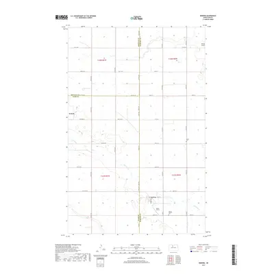
2017 Map of Deering
USGS Topo · Published 2017About this map
The intersection of McHenry, Ward, and Renville counties defines this prairie landscape, where the town of Deering serves as a local hub. Situated along Co Hwy 23, the community is anchored by the Deering Lutheran Cem and the nearby Millers Airstrip, reflecting the importance of both road and air connectivity in this rural region. To the northwest, the settlement of Wolseth sits near the winding path of Little Deep Cr, a drainage that cuts through the agricultural grid. The map reveals a highly structured township and range system, with cemeteries like Bethel Cem placed at interval crossroads, marking the resting places of early farming families. Numerous small wetlands and depressions dot the sections, characteristic of the glacial pothole region, while Spring Coulee drains the northeastern corner of the quadrangle.
Find a feature on this map
41 named features on this map. Tap any name to fly to it.
Don’t see what you’re looking for? This feature index may not catch every label — zoom into the map to look around manually.
Map Details
Editions of this 2017 Deering Map
This is the sole edition of this map. No revisions or reprints were ever made.
Other maps of this area

1948 · Newburg SW
USGS Topo · 1:24,000

1949 · Glenburn
USGS Topo · 1:24,000

1949 · Deering NW
USGS Topo · 1:24,000

1949 · Deering SW
USGS Topo · 1:24,000

1949 · Newburg SW
USGS Topo · 1:24,000

1949 · Deering SE
USGS Topo · 1:24,000

1949 · Granville NW
USGS Topo · 1:24,000

1949 · Granville SW
USGS Topo · 1:24,000

1949 · Eckman SE
USGS Topo · 1:24,000

1949 · Deering
USGS Topo · 1:24,000