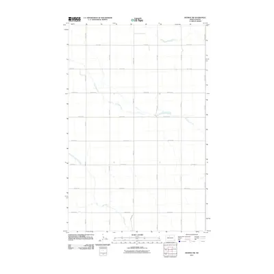
2011 Map of Deering NW
USGS Topo · Published 2011About this map
Little Deep Creek meanders through the northern plains of Ward County in this modern topographic study, showing a landscape defined by systematic agricultural sectioning. The terrain is structured by a rigorous grid of section lines and rural routes, such as County Hwy-6 and 198th Ave NE, which reflect the enduring influence of the Public Land Survey System on North Dakota's settlement patterns. The drainage is defined by the winding paths of Egg Creek and the larger Little Deep Creek, which break the geometric precision of the township and range lines. This map serves as a primary reference for understanding the rural infrastructure and hydraulic layout of the Deering region at the beginning of the 2010s, focusing on the essential crossroads and watercourses that sustain this prairie environment.
Find a feature on this map
24 named features on this map. Tap any name to fly to it.
Don’t see what you’re looking for? This feature index may not catch every label — zoom into the map to look around manually.
Map Details
Editions of this 2011 Deering NW Map
This is the sole edition of this map. No revisions or reprints were ever made.
Other maps of this area

1948 · Lansford
USGS Topo · 1:62,500

1948 · Burlington
USGS Topo · 1:62,500

1949 · Glenburn
USGS Topo · 1:24,000

1949 · Deering NW
USGS Topo · 1:24,000

1949 · Deering SW
USGS Topo · 1:24,000

1949 · Deering SE
USGS Topo · 1:24,000

1949 · Lansford SE
USGS Topo · 1:24,000

1949 · Burlington SE
USGS Topo · 1:24,000

1949 · Eckman SE
USGS Topo · 1:24,000

1949 · Deering
USGS Topo · 1:24,000