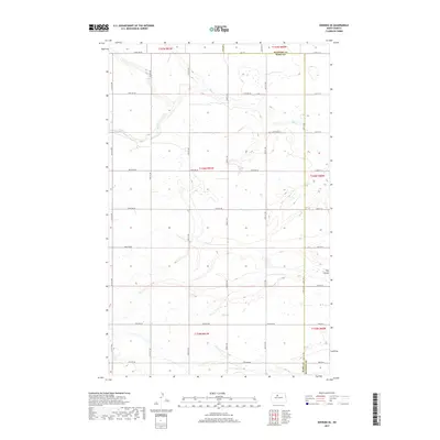
2017 Map of Deering SE
USGS Topo · Published 2017About this map
The rolling prairies of the North Dakota interior are prominently defined by the course of Egg Cr and Hay Coulee as they traverse this section of the Souris River basin. Located along the boundary of McHenry and Ward counties, the map documents a strictly rectilinear landscape of section lines and gravel roads. This 2017 topographic survey illustrates a rural environment primarily dedicated to agriculture, where the natural hydrology of the coulees dictates the placement of roads such as 100th Ave NE and 114th Ave NE. The dense network of seasonal wetlands and small prairie potholes visible between the surveyed section corners reveals the complex drainage patterns inherent to this glaciated terrain.
Find a feature on this map
28 named features on this map. Tap any name to fly to it.
Don’t see what you’re looking for? This feature index may not catch every label — zoom into the map to look around manually.
Map Details
Editions of this 2017 Deering SE Map
This is the sole edition of this map. No revisions or reprints were ever made.
Other maps of this area

1929 · Sawyer
USGS Topo · 1:62,500

1948 · Velva
USGS Topo · 1:62,500

1948 · Surrey
USGS Topo · 1:24,000

1949 · Norwich
USGS Topo · 1:24,000

1949 · Sawyer NE
USGS Topo · 1:24,000

1949 · Deering NW
USGS Topo · 1:24,000

1949 · Deering SW
USGS Topo · 1:24,000

1949 · Deering SE
USGS Topo · 1:24,000

1949 · Granville NW
USGS Topo · 1:24,000

1949 · Granville SW
USGS Topo · 1:24,000