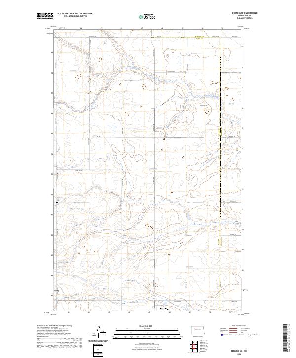
2024 Map of Deering SE
USGS Topo · Published 2024About this map
The winding course of Egg Creek dominates the northern half of this prairie landscape, carving a distinct drainage pattern through the sections of Ward and McHenry counties. The transition from the rural township boundaries of t156n r81w and t157n r81w into the more settled southern reaches reveals the growth of Surrey, where the grid of modern roads meets established homestead boundaries. Evidence of the area's cultural history is preserved at the Old German Baptist Cem on the western edge of the quadrangle. To the southeast, the terrain softens around Hay Coulee, a seasonal drainage that illustrates the subtle topography characteristic of this part of the North Dakota plains, where small wetlands and depressions punctuate the cultivated fields and cattle ranges.
Find a feature on this map
29 named features on this map. Tap any name to fly to it.
Don’t see what you’re looking for? This feature index may not catch every label — zoom into the map to look around manually.
Map Details
Editions of this 2024 Deering SE Map
This is the sole edition of this map. No revisions or reprints were ever made.
Other maps of this area

1929 · Sawyer
USGS Topo · 1:62,500

1948 · Velva
USGS Topo · 1:62,500

1948 · Surrey
USGS Topo · 1:24,000

1949 · Norwich
USGS Topo · 1:24,000

1949 · Sawyer NE
USGS Topo · 1:24,000

1949 · Deering NW
USGS Topo · 1:24,000

1949 · Deering SW
USGS Topo · 1:24,000

1949 · Deering SE
USGS Topo · 1:24,000

1949 · Granville NW
USGS Topo · 1:24,000

1949 · Granville SW
USGS Topo · 1:24,000